


SHIRE OF WILLIAMS
Williams, one of the oldest settled areas in Western Australia, is ideally situated about 160kms south of Perth (the capital city of WA), on the Albany Highway and is the "Gateway to the Great Southern Region".
From here it's a leisurely two-hour drive to get to either the city, the coast or the South-West.
In addition to being a wool, livestock and grain producing area, recent years have seen the town expand in residential building, tourism related development and the establishment of an industrial area.
Williams is notable for its magnificent display of "500 roses in 400m" in the main street over the summer and well into the cooler months. This has become an attraction to visitors, who can often be found admiring, photographing and 'smelling the roses'.
Much more than a pit stop for travellers, this friendly farming community has much to offer.
The town site of Williams is the main townsite within the Shire and is well serviced with a variety of places to eat, relax and stay. Around 1000 people call the Shire home, with approximately 400 living in the town centre and the remainder in the surrounding region.
The District of Williams was first explored in 1831 by Captain Bannister enroute from Perth to King George III Sound (Albany). Williams has been a convenient stopping place for travellers on the same route since the 1850’s. With the tendering of a reliable mail service around 1853, the road was upgraded and Williams became an important stop over point for passengers and changing of horses. It subsequently developed as the District Centre for Local Government, which was granted in 1877.
The small town was subject to increasing floods due to the clearing of the land for intensive farming, therefore the town was relocated to the Perth side of the bridge. The town site was surveyed in 1905 and most of the buildings in the present town site were constructed after that time. Williams is still a strong agricultural area reliant on sheep, wool, cattle and coarse grains. Increasingly it is servicing the growing tourism sector as more and more visitors are visiting or travelling through the region. Around 4000 vehicles per day travel through the townsite, significantly more during the tourism peak periods (school holidays and long weekends).
As Williams is located on the very busy Albany Highway, a significant driver for the local economy includes servicing the travelling public with food and fuel. It is a popular place to stop and take a break on a long journey. A number of local manufacturing industries and service businesses are located in Williams, taking advantage of the strategic transport routes that pass through the town.
The district enjoys a moderate climate characterised by warm dry summers and cool wet winters with average temperatures ranging from a minimum of 3º to a maximum of 25º in winter and a minimum of 20º to a maximum of 35º in summer. The warmest months are January and February. The average annual rainfall for the Shire of Williams is 550mm.
Facilities/Services
-
Williams Licensed Post Office
-
Williams Pharmacy
-
ATMs located in BP Roadhouse and Williams Woolshed
-
Williams Swimming Pool (located at the Sport & Recreation Ground)
 015 |  DSC00614 |
|---|---|
 St Boniface Church - Quindanning (1) |  Aug Sep Oct 2013 263 |
 DSC00496 |  BB Fairy-wren |
 009 | 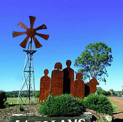 Entry Statement |